Micronesia Challenge: Protected Areas Network
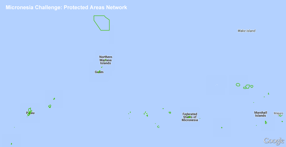
Boundaries of all known protected areas within Micronesia as compiled by the Micronesia Challenge, a commitment launched in 2006 by Micronesian governments to strike a critical balance between the need to use their natural resources today and the need to sustain those resources for future generations. Five Micronesian governments--the Republic of Palau, the Federated States of Micronesia (FSM), the Republic of the Marshall Islands (RMI), the U.S. Territory of Guam, and the Commonwealth of the Northern Mariana Islands (CNMI)--have committed to "effectively conserve at least 30 percent of the near-shore marine resources and 20 percent of the terrestrial resources across Micronesia by 2020." This region-wide initiative evolved from local conservation projects across Micronesia and is now a large-scale partnership between governments, nonprofit and community leaders, and multinational agencies and donors. Partners include NOAA, The Nature Conservancy (TNC), Conservation International, and others. For further information, please see: http://www.micronesiachallenge.org
Data and Resources
-
OGC-WFS
WFS
Open Geospatial Consortium Web Feature Service (WFS). Supported WFS versions...
-
OGC-WMS
WMS
Open Geospatial Consortium Web Map Service (WMS). Supported WMS versions...
-
GeoServer
This URL provides access to this dataset via GeoServer, which offers multiple...
-
GeoExplorer
This URL provides a viewer for this dataset.
-
Unnamed resource
-
Unnamed resource
-
Unnamed resource
-
OGC-WMS-C
WMS
Open Geospatial Consortium Web Map Service - Cached (WMS-C). Use of WMS-C is...
-
ISO-19139 (Local) Metadata
The XML content as stored locally by CKAN
-
ISO-19139 (IOOS Registry)
The XML content as published by the IOOS Registry
Graphic Preview
Metadata Date
Metadata Tags
| Online Access |
OGC:WFS (OGC Web Feature Service) These data are available for access with an OGC WFS compatible client OGC:WMS (OGC Web Map Service) These data are available for access with an OGC WMS compatible client
|
| Distributor | The Nature Conservancy (TNC) Pacific Islands |
| Point of Contact |
The Nature Conservancy (TNC) Pacific Islands asiapacific@tnc.org Online Resource |
| Originator |
The Nature Conservancy (TNC) Pacific Islands asiapacific@tnc.org Online Resource |
| Publisher |
Pacific Islands Ocean Observing System (PacIOOS) info@pacioos.org Online Resource |
| Dataset Point of Contact |
Pacific Islands Ocean Observing System (PacIOOS) info@pacioos.org |
| General Documentation | |
| Associated Documentation |
Pacific Islands Ocean Observing System (PacIOOS)
|
| Date(s) |
creation:
2016-01-25
issued: 2016-01-25 revision: 2016-01-25 creation: 2016-01-25 issued: 2016-01-25 revision: 2016-01-25 creation: 2016-01-25 issued: 2016-01-25 revision: 2016-01-25 creation: 2016-01-25 issued: 2016-01-25 revision: 2016-01-25 |
| Purpose | PacIOOS provides timely, reliable, and accurate ocean information to support a safe, clean, productive ocean and resilient coastal zone in the U.S. Pacific Islands region. |
| Use Limitations |
The data may be used and redistributed for free but is not intended for legal use, since it may contain inaccuracies. Neither the data Contributor, University of Hawaii, PacIOOS, NOAA, State of Hawaii nor the United States Government, nor any of their employees or contractors, makes any warranty, express or implied, including warranties of merchantability and fitness for a particular purpose, or assumes any legal liability for the accuracy, completeness, or usefulness, of this information.
|
| Spatial Bounding Box Coordinates | N: 21.3977947261937° S: 2.79623770639863° E: 171.998484947768° W: 131.722000124223° |
| Theme keywords |
GCMD Science Keywords
|
| Data Center keywords |
GCMD Data Center Keywords
|
| Place keywords |
GCMD Location Keywords
|
| Project keywords |
GCMD Project Keywords
|
| Use Constraints |
The data may be used and redistributed for free but is not intended for legal use, since it may contain inaccuracies. Neither the data Contributor, University of Hawaii, PacIOOS, NOAA, State of Hawaii nor the United States Government, nor any of their employees or contractors, makes any warranty, express or implied, including warranties of merchantability and fitness for a particular purpose, or assumes any legal liability for the accuracy, completeness, or usefulness, of this information.
|
| Lineage Statement | 2016-01-25T00:00:00Z OGC web services (WMS and WFS) enabled by PacIOOS via GeoServer. Original data from source provider may have been reformatted, reprojected, or adjusted in other ways to optimize these capabilities. |
| Platforms | |
|---|---|
| Ingestion Attributes | |
| Instrument Attributes | |
| Attribution Information | |
| CF related |