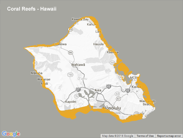
Coral Reefs - Hawaii
This dataset represents a subset of the global distribution of warm water coral reefs for Hawaii and should be seen as an "interim" product. It has been compiled from a number of data sources which have been merged together by UNEP-WCMC and the WorldFish Centre in collaboration with WRI and TNC. It supersedes the dataset used in the World Atlas of Coral Reefs (2001), although some aspects of this product still originate from that data source. This amalgamated dataset has been created to further mobilise the Millennium Coral Reef Map Products and their validation. This data set should by no means replace the official release of the Millennium coral reef map and users should always check at the official sites for the most up-to-date available information. This dataset does not contain the full 5 level geomorphological categorization. In part, for the validated products, it maintains the simplified Reefbase subset but for the remaining areas i.e. the unvalidated data and data from other sources, there is only a single class to indicate coral reef. When using these data, please cite the following: UNEP-WCMC, WorldFish Centre, WRI, TNC (2010). Global distribution of warm-water coral reefs, compiled from multiple sources including the Millennium Coral Reef Mapping Project. Version 1.3. Includes contributions from IMaRS-USF and IRD (2005), IMaRS-USF (2005) and Spalding et al. (2001). Cambridge (UK): UNEP World Conservation Monitoring Centre. For more information go to: http://data.unep-wcmc.org/datasets/1
Data and Resources
-
OGC-WFS
WFS
Open Geospatial Consortium Web Feature Service (WFS). Supported WFS versions...
-
OGC-WMS
WMS
Open Geospatial Consortium Web Map Service (WMS). Supported WMS versions...
-
GeoServer
This URL provides access to this dataset via GeoServer, which offers multiple...
-
GeoExplorer
This URL provides a viewer for this dataset.
-
PacIOOS Voyager (Google Maps API)
This URL provides a viewer and/or data access for this dataset.
-
UNEP-WCMC Ocena Data Viewer
This URL provides a viewer and/or data access for this dataset.
-
Unnamed resource
-
Unnamed resource
-
Unnamed resource
-
OGC-WMS-C
WMS
Open Geospatial Consortium Web Map Service - Cached (WMS-C). Use of WMS-C is...
-
ISO-19139 (Local) Metadata
The XML content as stored locally by CKAN
-
ISO-19139 (IOOS Registry)
The XML content as published by the IOOS Registry
Graphic Preview
Metadata Date
Metadata Tags
| Online Access |
OGC:WFS (OGC Web Feature Service) These data are available for access with an OGC WFS compatible client OGC:WMS (OGC Web Map Service) These data are available for access with an OGC WMS compatible client
|
| Distributor | United Nations Environment Programme World Conservation Monitoring Centre (UNEP-WCMC) |
| Point of Contact |
United Nations Environment Programme World Conservation Monitoring Centre (UNEP-WCMC) info@unep-wcmc.org Online Resource |
| Originator |
United Nations Environment Programme World Conservation Monitoring Centre (UNEP-WCMC) info@unep-wcmc.org Online Resource |
| Publisher |
Pacific Islands Ocean Observing System (PacIOOS) info@pacioos.org Online Resource |
| Dataset Point of Contact |
Pacific Islands Ocean Observing System (PacIOOS) info@pacioos.org |
| General Documentation | |
| Associated Documentation |
Pacific Islands Ocean Observing System (PacIOOS)
|
| Date(s) |
creation:
2016-01-28
issued: 2016-01-28 revision: 2016-01-28 creation: 2016-01-28 issued: 2016-01-28 revision: 2016-01-28 creation: 2016-01-28 issued: 2016-01-28 revision: 2016-01-28 creation: 2016-01-28 issued: 2016-01-28 revision: 2016-01-28 |
| Purpose | PacIOOS provides timely, reliable, and accurate ocean information to support a safe, clean, productive ocean and resilient coastal zone in the U.S. Pacific Islands region. |
| Use Limitations |
The data may be used and redistributed for free but is not intended for legal use, since it may contain inaccuracies. Neither the data Contributor, University of Hawaii, PacIOOS, NOAA, State of Hawaii nor the United States Government, nor any of their employees or contractors, makes any warranty, express or implied, including warranties of merchantability and fitness for a particular purpose, or assumes any legal liability for the accuracy, completeness, or usefulness, of this information.
|
| Spatial Bounding Box Coordinates | N: 28.4609060972388° S: 18.9657959721066° E: -155.006673840525° W: -178.384613894316° |
| Theme keywords |
GCMD Science Keywords
|
| Data Center keywords |
GCMD Data Center Keywords
|
| Place keywords |
GCMD Location Keywords
|
| Project keywords |
GCMD Project Keywords
|
| Use Constraints |
The data may be used and redistributed for free but is not intended for legal use, since it may contain inaccuracies. Neither the data Contributor, University of Hawaii, PacIOOS, NOAA, State of Hawaii nor the United States Government, nor any of their employees or contractors, makes any warranty, express or implied, including warranties of merchantability and fitness for a particular purpose, or assumes any legal liability for the accuracy, completeness, or usefulness, of this information.
|
| Lineage Statement | 2016-01-28T00:00:00Z OGC web services (WMS and WFS) enabled by PacIOOS via GeoServer. Original data from source provider may have been reformatted, reprojected, or adjusted in other ways to optimize these capabilities. |
| Platforms | |
|---|---|
| Ingestion Attributes | |
| Instrument Attributes | |
| Attribution Information | |
| CF related |